


Notasulga Town Hall, Macon County, Alabama
About
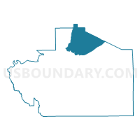
Outline

Summary
| Unique Area Identifier | 522322 |
| Name | Notasulga Town Hall |
| County | Macon County |
| State | Alabama |
| Area (square miles) | 47.11 |
| Land Area (square miles) | 46.81 |
| Water Area (square miles) | 0.30 |
| % of Land Area | 99.36 |
| % of Water Area | 0.64 |
| Latitude of the Internal Point | 32.52193350 |
| Longtitude of the Internal Point | -85.67229870 |
Maps


Graphs
Select a template below for downloading or customizing gragh for Notasulga Town Hall, Macon County, Alabama


Neighbors
Neighoring Voting District (by Name) Neighboring Voting District on the Map
- Chehaw Fire Station, Macon County, AL
- Churchhill Voting House, Tallapoosa County, AL
- Franklin Town Hall, Macon County, AL
- Little Texas Voting Center, Macon County, AL
- Loachapoka, Lee County, AL
- National Guard Armory, Macon County, AL
- Reeltown Vol Fire Department, Tallapoosa County, AL
- Woodland Community Center, Macon County, AL
Top 10 Neighboring County Subdivision (by Population) Neighboring County Subdivision on the Map
- Tuskegee CCD, Macon County, AL (12,834)
- Loachapoka-Roxana CCD, Lee County, AL (7,236)
- Tallassee CCD, Tallapoosa County, AL (6,166)
- Notasulga CCD, Macon County, AL (3,156)
Top 10 Neighboring Place (by Population) Neighboring Place on the Map
Top 10 Neighboring Unified School District (by Population) Neighboring Unified School District on the Map
- Lee County School District, AL (56,237)
- Tallapoosa County School District, AL (22,443)
- Macon County School District, AL (21,452)
Top 10 Neighboring State Legislative District Lower Chamber (by Population) Neighboring State Legislative District Lower Chamber on the Map
Top 10 Neighboring State Legislative District Upper Chamber (by Population) Neighboring State Legislative District Upper Chamber on the Map
Top 10 Neighboring 111th Congressional District (by Population) Neighboring 111th Congressional District on the Map
Top 10 Neighboring Census Tract (by Population) Neighboring Census Tract on the Map
- Census Tract 410, Lee County, AL (7,236)
- Census Tract 9627, Tallapoosa County, AL (6,166)
- Census Tract 2315, Macon County, AL (3,156)
- Census Tract 2316.03, Macon County, AL (1,307)